• Skip to primary navigation
  • Skip to main content
  • Texas A&M Forest Service
  • Texas A&M Veterinary Medical Diagnostics Laboratory
  • Texas A&M AgriLife Extension Service
  • Texas A&M AgriLife Research
  • Texas A&M College of Agrculture and Life Sciences
Aquaculture, Fisheries, & Pond Management
Aquaculture, Fisheries, & Pond ManagementTeaching, Research, Extension and Service
  • Menu
  • Home
  • About Us
  • Forms & Permits
  • Fish Die-Offs
  • Aquatic Diagnostics Lab
  • Events & Learning

Water Chemistry of Well and Surface Waters in Texas

Geographic Information System (GIS) maps are a valuable tool that can be used to help determine the chaemical components of water in your area. Below are several different types of bodies of water along with a link to their corresponding GIS maps. The data used to create these maps was compiled from submissions to the Texas A&M Soils Water and Forage Testing Laboratory.

EWF-017 Understanding Water Quality Reports for Your Pond

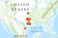
Private Lake Water Quality

http://www.arcgis.com/home/webmap/viewer.html?webmap=d81a040bf87b4806a84855c6c5d39de8
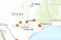
 

Other Water Quality

http://www.arcgis.com/home/webmap/viewer.html?webmap=f55114dac1384fc3a29222b1fb0ffa33


Pond Water Quality

http://www.arcgis.com/home/webmap/viewer.html?webmap=fab39ddbd3704a49bd98421fe57239b4


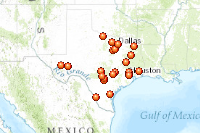
Stream Water Quality

http://www.arcgis.com/home/webmap/viewer.html?webmap=82263bb5723e4b86a991f07c5014b3d3
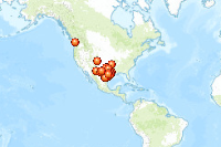
 

Well Water Quality

http://www.arcgis.com/home/webmap/viewer.html?webmap=7c624e354f6a477d81e5d5a55db7c4cc


Print Friendly, PDF & Email
Texas A&M AgriLife Extension Service
Texas A&M University System Member
  • Compact with Texans
  • Privacy and Security
  • Accessibility Policy
  • State Link Policy
  • Statewide Search
  • Veterans Benefits
  • Military Families
  • Risk, Fraud & Misconduct Hotline
  • Texas Homeland Security
  • Texas Veteran's Portal
  • Equal Opportunity
  • Open Records/Public Information